
"Resident Assessment Tool"
“Analysis of NPU-L Environment to Help Residents Resist Gentrification”
In many underinvested, urban communities the announcement of new construction, that is expected to serve as a symbol for equitable investment, are largely perceived as a dog-whistle for incoming gentrification. For design practitioners looking to provide support to underinvested populations, the renewal of historic spaces often displaces the presence of the people that inspired the original design intervention. Exploring this relationship between design and displacement, specifically the possibility of doing the former without perpetuating the latter, was the implicit inquiry that inspired this Master’s of Industrial Design Thesis Study.
[BACKGROUND]
Gentrification is a systemic, socio-economic development that heavily impacts low-income residents who are vulnerable to the rising cost-of-living that follows the construction of new, commercial developments. In West Atlanta neighborhoods, home to rich legacy starting before the Civil Rights era, residents are aware that this change in infrastructure will not only disenfranchise families that already find housing unaffordable but will likely usher in an erasure of the area’s identity as historic, predominantly Black neighborhoods.
The creation of Atlanta’s historic Neighborhood Planning Unit (NPU) system, created by Atlanta’s first Black mayor, were designed to empower neighborhoods like English Avenue and Vine City (which make up NPU-L) to use their collective voice to advocate for their best-interest on local issues relating to licensing, zoning, and land-use. For NPU-L, these meetings serve as an important platform to create collective resistance to the recent developments proposed by commercial stakeholders looking to receive approval from the city government to use these neighborhood’s land.
[Opportunity]


While anti-gentrification efforts in the US are often approached from the occupational perspective of property law, public policy, and city-planning, there are very few instances where human-centered approaches to this systematic issue are addressed using competencies that are associated with the field and practice of design.
This thesis study looked to analyze what opportunities might exist to introduce a design-intervention that would not further the financial inequity that underpins gentrification. Upon identifying this opportunity, specifically within the NPU-L geography, the goal was to explore if this proposed output of this study could actually support residents in discouraging development that is perceived as negligent to current-state, residential concerns.
[FOcus]
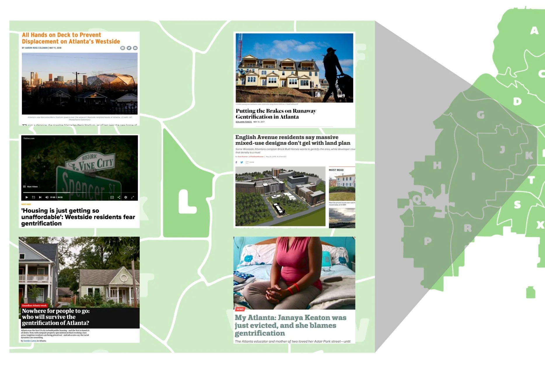
Through the application of design research methods, audit and analysis of the NPU-L ecosystem would be conducted to understand how the relational and material interactions in these meeting spaces currently influence civic discourse, the medium that residents use to openly resist gentrification via votes against incoming development proposals.
Upon identifying an opportunity for design to provide improvement to this civic process, the synthesis of this research would be directed towards producing design recommendations that empower the current technology and processes present in the NPU-L space. To explore design’s capability to work in this local setting, as opposition to the larger, systematic process of gentrification, could provide foundational insight on how to support the resistance efforts of communities, both in and outside of Atlanta, with viable, contextual design solutions.
[Metrics]
-
Can an NPU-L resident use any provided tool to place proposed development and perform contextual sense-making to consider the positive or negative influence this will have on the NPU?
-
Do NPU-L residents like the feature, aesthetic, and content choices made in the current iteration of the tool?
-
Do NPU-L residents feel as if the tool accommodates their request for information, civic engagement, and community decision-making?
[CAUSAL research]







-
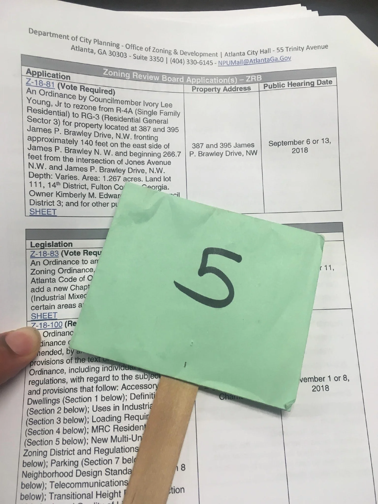
As a qualified, voting-member of NPU-L, immersion into the monthly meeting space provided a full-participant vantage point to understand the activity, context, and culture of this community’s interaction with a number of city and development representatives. During this 10-month span over 8 meetings in NPU-L were attended in-person, 3 meetings were observed through prior recordings posted for public record, and 3 meetings of NPUs located adjacent to L were observed as a marginal participant (since voting rights are not provided to non-residents).
-
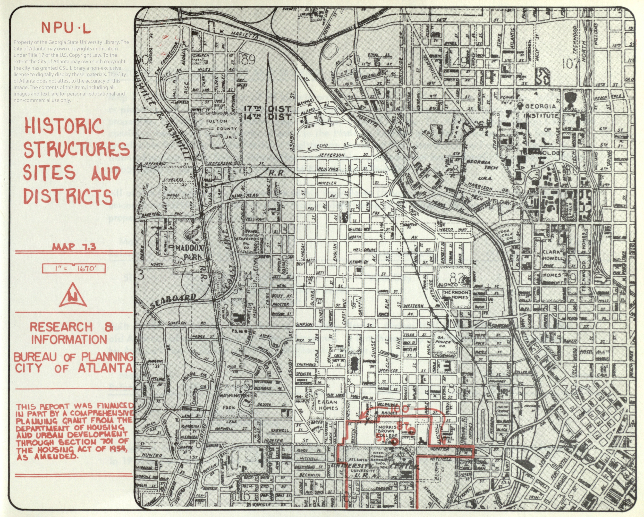
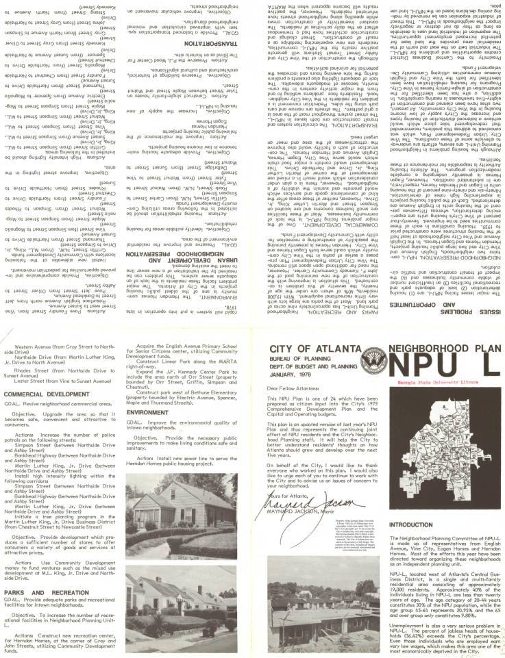
To help inform the operations observed across NPUs, several subject-matter expert interviews were conducted with city officials, community leaders, and employees of a local nonprofit focused on civic engagement. From these interviews individuals – who had spent years providing both support and resistance to Atlanta’s land-use permitting process – cited several documents that provided spatial and geographic mapping as a means for reference, review, and advocacy within the city-planning department as it related to resource distribution and land-use. Documents, some as old as the NPU system themselves, served as an important precedent for this study due to one common feature: all of these resources provided a visual companion to outline the current-state of NPU-specific assets while detailing the unique, future aspirations of each neighborhood. The importance of this feature was reported, through these interviews, as a way to provide record and accountability in the relationship held between residents and city-officials.
-
This deeper analysis of the NPU-L meeting space was conducted with the interest of examining the specific touchpoints that residents experienced with human and non-human entities during their monthly meetings. This framework allowed for the larger contextual inquiry of this civic space to focus on what opportunities were already present within the space to be improved based on what relationships were present and/or absent from the task-flow of the monthly meeting structure. This led to the specific highlighting of two sub-cultures that were consistently present within each meeting:
-
The interactions observed between “Representatives”, coming to the meeting on behalf of the city or real-estate development firm and local “Residents”, either new or celebrated as historic homeowners, continually demonstrated an inequitable approach to civic discourse. This imbalance was the source of several explicit conflicts where residents voiced their distrust, apprehension, and concern for the negligence / perceived predatory-nature shown by these individuals.
-
Based on the common table-and-chair-layout assumed by all NPU meetings, an implicit designation of “stage” and “audience” provided an imbalance in expectation and authority amongst visitors and residents. This misrepresentation of authority was often perpetuated by (a) the large volume of material that was provided to residents at the start of the meeting to review only minutes before the session started or (b) the only visual reference provided to residents for review: a prospective 2D / 3D rendering of a new development being proposed for immediate approval by voting members.
[Generative ReseaRch]
Research Through Design
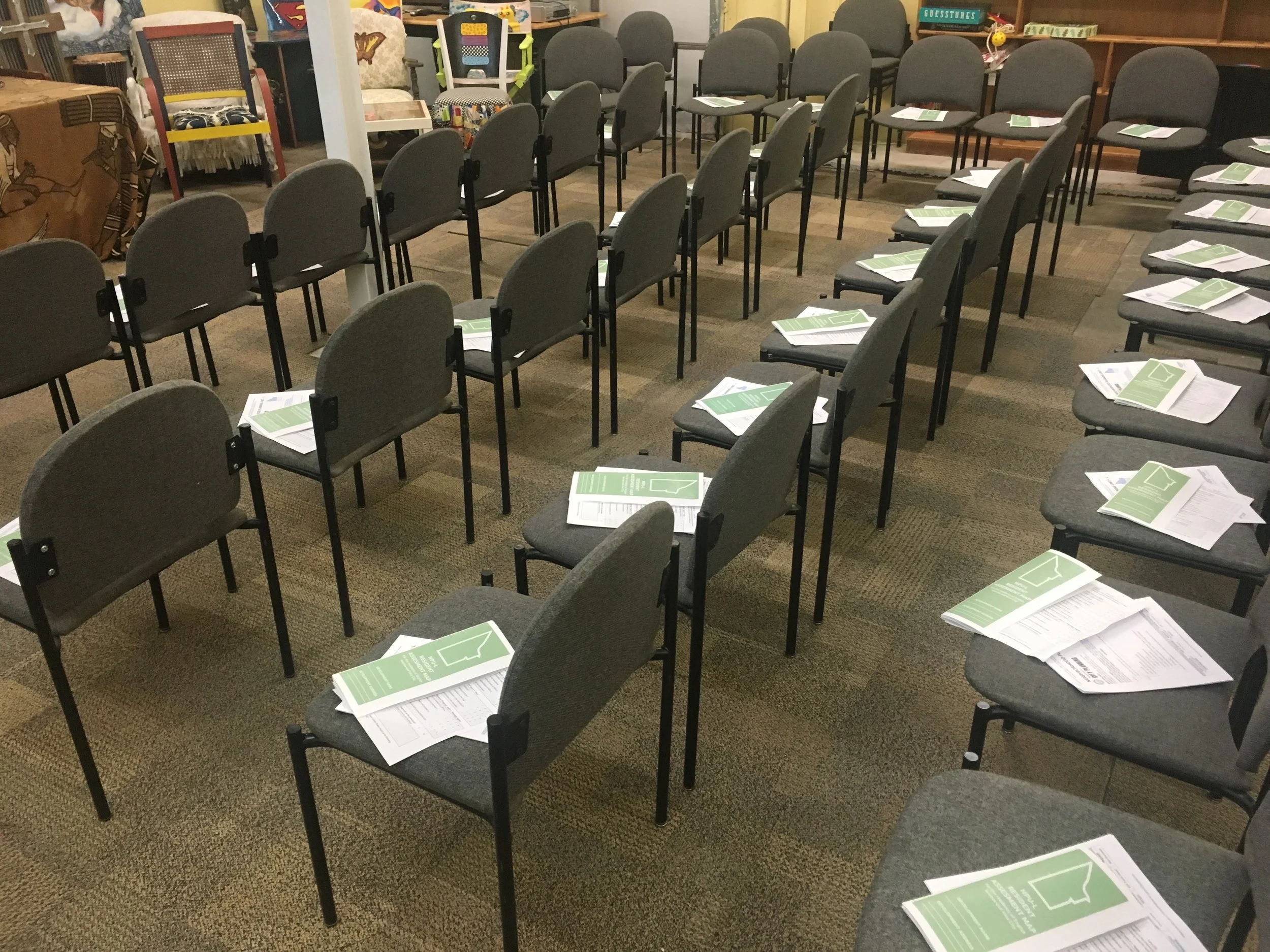
This research method was heavily encouraged by my thesis committee as means to validate if the opportunities for design-intervention, identified through my prior research-phase could actually provide material support to NPU-L’s discourse with developers. This applied research attempt led to the construction of rapid prototypes that took direct inspiration from archived, visual civic-documents to try and replicate the geo-spatial convenience they used to provide for resident-sourced city-planning. This led to two sub-studies which drove the validation efforts of this design effort:
[Evaluative ReseaRch]
-
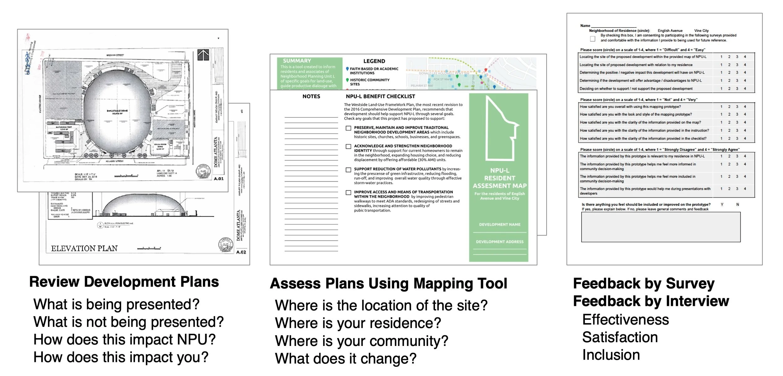
To account for the lack of visual context and overlay of current-state community goals in meetings, the prototype was designed to focus on supporting the following goals:
(a) contextualizing future-state development proposals as they related to full, current-state geography of that NPU
(b) provide educational excerpts to make commonly-used land-use / civic definitions easily accessible to the public
(c) guide civic discourse with developers through standardized talking points that were directly sourced from the community’s record of goals.
The interest was for this mock-up to seemingly translate the jargon and renders proposed by developers into a format that could be easily accessible to residents without requiring additional accompanying resources or a moderate sense of digital literacy. -
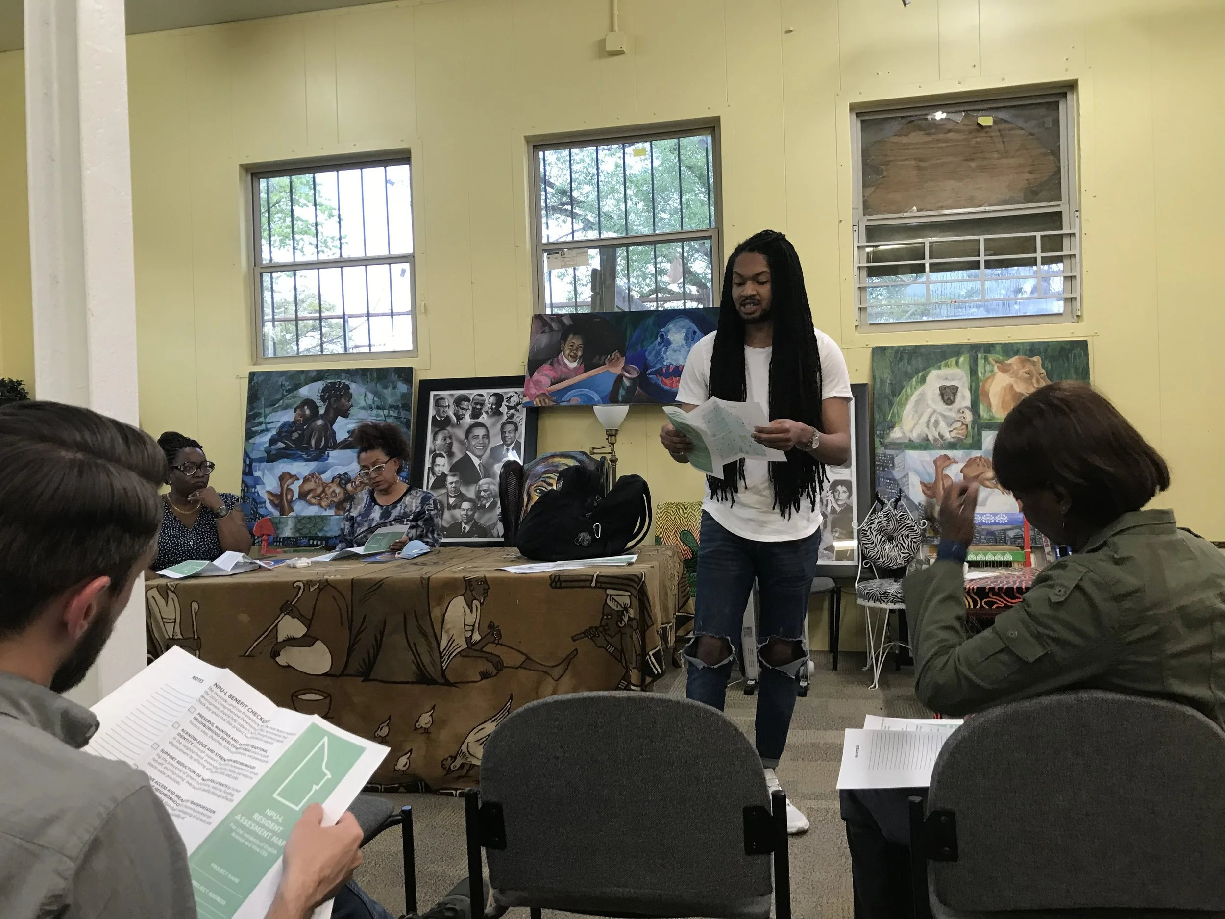
To generate empirical evidence on the mock-ups' usefulness in the civic-setting it was intended to be used, a test was designed to provide the mock-up to residents with the regular material they would receive at the start of meetings. Once residents reached the portion of the meeting that required review and voting, facilitation was provided to help give audience members time and opportunity to complete the same exact tasks they’d been observed completing in scenarios where no mock-up was usually provided. At the end of this test, participants were provided with a feed-back survey to assess the mock-up relevant to the project’s KPIs. This test was conducted twice on-site and an online version of the feedback survey was provided for residents to provide feedback in the event that they did not want to provide an interview post-meeting.
[Key Insights]

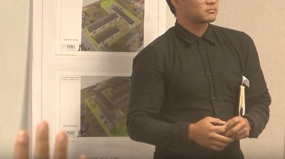

In addition to foregoing opportunities for early community input, many developer’s NPU presentations lacked effective visual context to help inform residents of the full impact their proposal would have on the adjacent houses, streets, or neighborhoods where it’d be constructed. Instead, they looked to leverage their expertise which was met with disdain by residents who had lived-experience that spanned much farther than those presenting. This lack of consideration was often perceived by residents as a clear lack of interest in investing in current-state community concerns and instead an attempt to politely commit displacement and social erasure. While this negligence was due, in part, to developer’s non-existent community-engagement strategy and vague presentation choices, one of the most notable issues discovered through this study implicated another physical artifact as an accomplice in impeding civic discourse: the monthly NPU agenda.
Each month, ahead of the meeting, the agenda is constructed digitally with hyperlinks to land-use applications that were required for review and voting by the NPU. This agenda, however, was physically printed and provided to residents without an analog way to review developer-submitted applications. This presented a consistent scenario where residents would meet in spaces where no technology, nor aptitude for using the necessary technology to view these digital plans, was made available to them. This lack of city-provided visuals, exhaustive developer-constructed visuals, and modern, community-sourced visuals served as the key motivation for my full list of design recommendations.
[Proposed Concept]


The “NPU-L Resident Assessment Map” is constructed as a tri-fold pamphlet which provides interactive instructions for residents to place their residence – and any development being proposed in a meeting – on an asset map of the NPU-L neighborhoods. In the final iteration of this concept, the interior of this tool provided overlays of data relevant to the location of neighborhood landmarks, environmental concerns, employers, current and projected transportation routes, and the average median income. The exterior of this tri-fold provided a condensed outline of the NPU-L goals – sourced from their contribution to the 2016 Comprehensive Development Plan – and space for residents to collect additional information during their discourse with developers to help them consider any additional data that was not currently mapped. While the primary intent of providing this information was to equip residents with a visual product that could serve as the central focus of NPU deliberations – thereby forcing developers to ground the discussion of their proposal to the current-state geography and residential concerns held by current residence – this information provided a secondary focus of helping unify resident-to-resident in-meeting conversations around common civic language, internal goals, and geographically-specific concerns that were only noted verbally due to the lack of visual products in traditional meetings.
In wanting to accommodate the need for a low-tech, portable solution, this concept was initially proposed as a single-use product that residents could use throughout a single meeting to evaluate any and all developments being presented and/or voted on. However, the intent of introducing this device would be to ultimately extract each component (i.e. the asset map, list of community goals, and glossary of additional NPU-L relevant publications) into larger stationary items that could be placed in the meeting-space for communal interaction. This would ideally allow tracking of development proposals over the course of several meetings, provide record for any community-identified assets that residents wanted to preserve, and allow a real-time understanding of how the NPU was being engaged by incoming construction either in support or disservice of their advocacy efforts.


[Outcome & INTEGRATION]
Coincidentally, this thesis study provided preliminary insight for a local civic organization, Center of Civic Innovation, running a more comprehensive study on the entire NPU system. The insights generated from this master’s thesis were later integrated into their funded, multi-year study as key considerations for the specific strategic and material support residents could receive to support their civic decision-making. After publishing this thesis study, an invitation was accepted to join the Advisory Board for CCI’s NPU project. In this role, the knowledge gained from studying the NPU-L environment was leveraged to help inform the deployment of CCI’s surveying process, provide feedback / review of their synthesized research, and help support their city-wide engagement efforts. The final edition of this succeeding study, delivered to Atlanta City Government and made available for public viewing, outlines explicit recommendations that would allow for the city to assume the responsibility for improving the entire NPU system in alignment with the key-insights that were sourced from this thesis study.
[Post-Project REFLECTION]
-
The main limitations that impacted this project were actually identical to the concerns of the residents often voiced to developers: a more comprehensive study would require a large investment of time, money, and expertise. Admittedly, as a graduate student with a tight deadline and no prior urban-planning / cartography knowledge, I lacked all three.
This, in conjunction to the deep feeling of survey fatigue NPU-L residents have gained from years of being research-subjects by the surrounding academic institutions, likely robbed this project’s outputs of being received as a revival of community-centric tools that Atlanta city-planning utilized at the inception of the NPU system.
-
By focusing on a NPU that has been historically resistant to large-scale development and working to continually mobilize to advocate for themselves in civic settings, the hope is that these insights could be applicable to other communities, both inside and outside of Atlanta, that are looking to engage with developers. However, because the approach of this project explicitly centered around surveying the environments and experiences of a marginalized group, very little time was allotted to validate this against the perspective of real-estate developers. It is completely plausible that the inclusion of this perspective as a secondary stakeholder, could further inform the generation of even more nuanced insights and future product-outputs.
-
Due to the COVID-19 pandemic, civic participation in the NPU system abruptly shifted to exclusively digital mediums, forcing residents to adapt to virtual-meeting platforms overnight. As a result, many of the physical-design constraints and inclusive measures to embrace stratified levels of tech-literacy, considerations that were integral to the contextual frame of this project, became inconsequential. In fact, the Department of City Planning now provides residents with a digital dashboard that allows them to access quantitative data that would have otherwise been unavailable to NPU meeting attendees in their traditional analog settings. WIth consideration for these two updates alone, there is notable opportunity to imagine new, hybrid outputs of this study that could serve as meaningful design interventions in Atlanta’s civic environment.


